Sinergise and Sentinel Hub at DragonHack 2020
During the weekend on November 7-8 we had a pleasure to participate at the Slovenia’s longest running and largest student hackathon - DragonHack. As supporters we had a chance to organize our own “Best Earth Observation Hack” challenge and offer the participants a possibility to freely use Sentinel Hub services for their hack. We were genuinely amazed by the results of participating teams, created in just 24 hours.
This year’s DragonHack was already sixth in a row, but for sure different than any before. All previous editions were held at the Faculty of Computer and Information Science in Ljubljana, Slovenia. Since this wasn’t possible this year due to the Covid19 restrictions, the organizers did an excellent job providing an online event, hosting 174 hackers and over 60 mentors.
The competition was above any expectations and our judges had a tough job to do. Among 14 teams which submitted their hacks to our challenge they had to choose the best of all. After a long consideration, we decided to award the "New-Folder" team. We hope that a one-year Sentinel Hub subscription in value of 5,000€ (Enterprise S package) will help them develop their idea further and reach the potential we see in it.
The Winning Idea
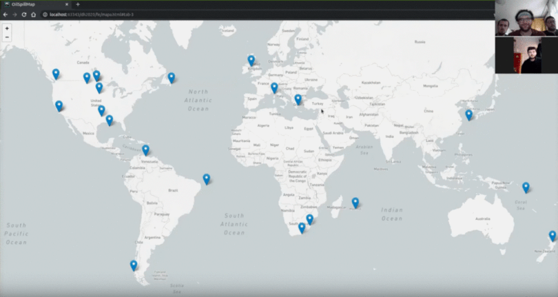
The winning project by the "New-Folder" team addresses the problem of oil spills with the intention of spreading its awareness. To achieve this goal, the team combined multiple data sources, such as Wikipedia, Twitter, and Sinergise’s satellite imagery provided through Sentinel Hub. All the data sources contain distinct information from which they gained statistics. They did all the data-crunching while preserving the data's integrity.
They’ve used satellite imagery for detection of the oil leaks and comparison between time stamps. For a given event, they scaned the coordinates and obtain the imagery in the interval of [day-30, day+30] and obtain a collection of unique satellite images of the given oil spill. For such sequence of days, the minimum number of images they obtained was 12 and the maximal number was 20. In the end, the images are compiled together in a time-lapse, for the user’s convenience.
To learn more about the project, see their submission here.
Some Other Ideas Submitted to Our Challenge
ICENGINE project
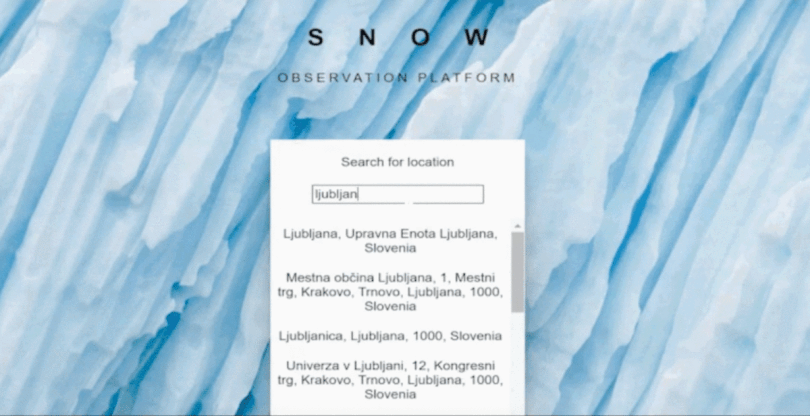
The “Razkuženi štirje” team showcased a Snow observation platform which helps to better understand and analyze snow coverage of a certain region. Platform can give a useful insight into the impact of global warming. This is done by analyzing the images from Sentinel Hub mainly using Python. From the provided data, they’ve extracted the percentage of snow coverage that helped analyze and plot graphs. Users can access the functionalities using a friendly interface developed in lightweight JavaScript Framework Mithril.js. Their solution is as simple as possible but offers a very powerful overview of snow coverage. Read more!
Fire Spreading project
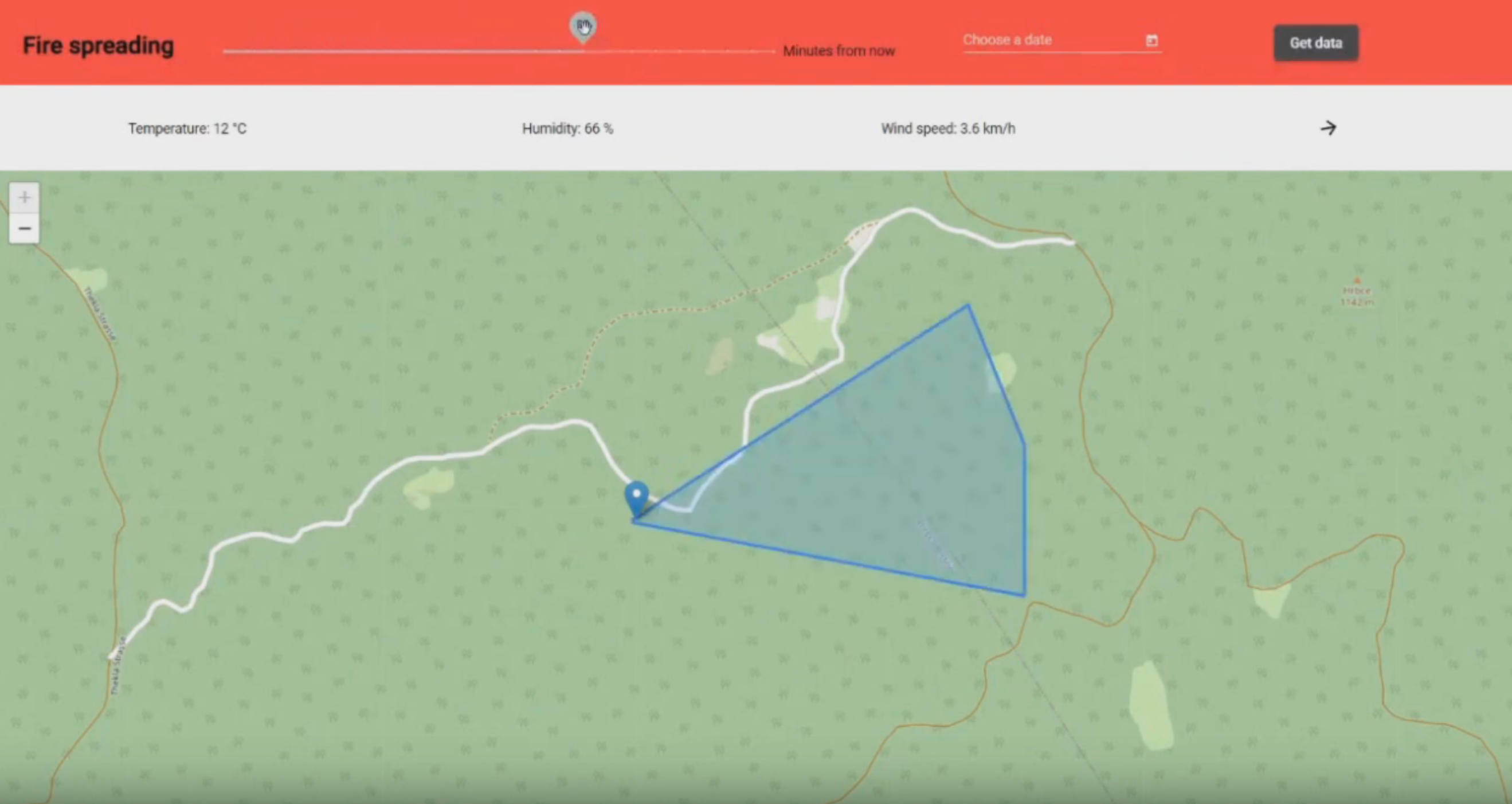
Knowing the pattern in which a wildfire will expand proves to be crucial information to the firefighters. With that in mind the “Red Dragons” team have created a tool which predicts the spread of a wildfire based on the surrounding area. User can select the starting hotspot of a fire from an interactive map and has the option to predict how the fire will spread in the first 120 minutes. Their prediction includes analysis of the current meteorological conditions, such as moisture, temperature, slope of the terrain as well as wind direction and speed to determine how a fire might spread. Read more!
Cities: Skyline Map Builder
The “Switcheroos” team have developed a way to play games on maps of Slovenian cities. With the help of multiple open source government databases and Sentinel Hub services, they've created height, vegetation and water images. By bundling all of this together, user can play the game Cities Skyline! A Python bot takes care of generating vegetation, whereas the height map gets automatically imported. They've also developed a nodejs solution to have a lovely dashboard where the generated maps will be hosted for users to access. Read more!
To find out more about other solutions, we recommend you to visit the event’s Project Gallery on the DevPost page where you will be able to filter submissions and find more interesting hacks.