Copernicus Data Space Ecosystem grows with new data collection: Enter Sentinel-2 Quarterly Cloudless Mosaics
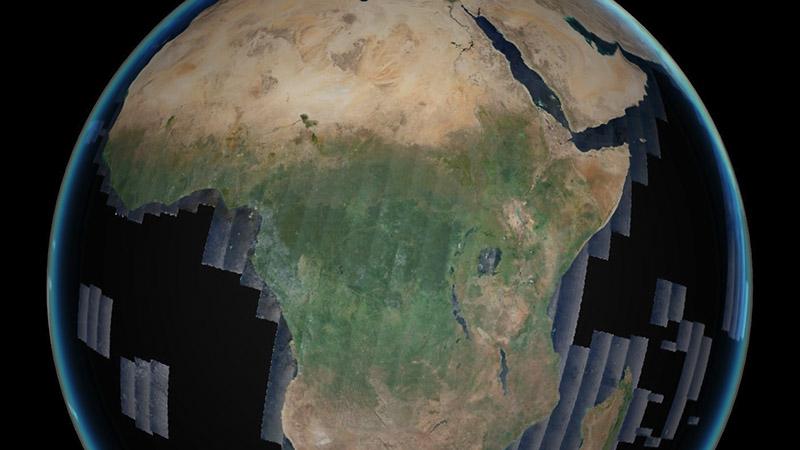
Many applications require seamless, unobscured, high-quality images, and are limited by swath width or cloud cover in the Sentinel-2 datasets. The observation of landscapes, the creation of large-scale open maps, but also agricultural and environmental monitoring benefit from Level 3 analysis-ready data. For this purpose, Quarterly Cloudless Sentinel-2 mosaics are now available in the Copernicus Data Space Ecosystem. These datasets are based on the Sentinel-2 Collection 1 with harmonised radiometry and geometry, using only the clear, cloud-free pixels based on the Level 2 scene classification. For each reference period of three months, the first quartile of the pixel value distribution was taken as a further measure against the remaining cloudy (bright) pixels. For even larger views, the dataset was resampled to a global mosaic with a low resolution of 20 meters.
These datasets are also available as data collections for STAC and OData API access, but also for streamlined in-code processing with the openEO and Sentinel Hub APIs. Visualization and download are possible via the Copernicus Browser, and data integration is available via the OGC API-based QGIS Plugin.
The dataset currently covers quarters 1, 2, 3 and 4 of 2023 and quarters 2, 3 and 4 of 2022, but will be updated with new and previous archive imagery.
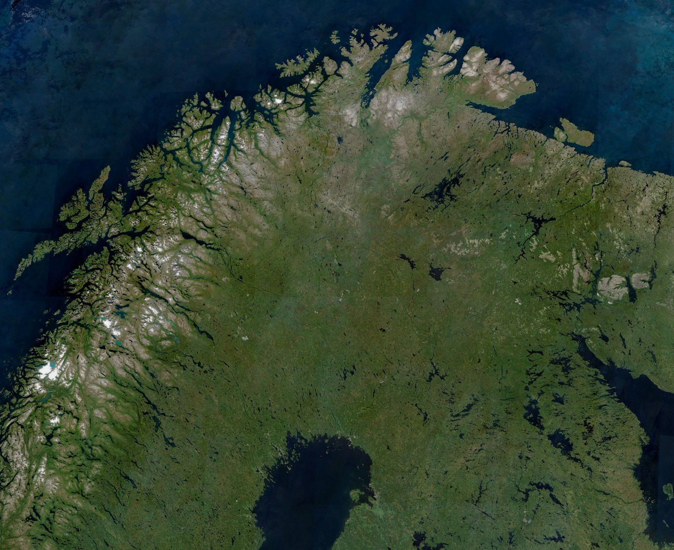 This example image is the 2022 April, May, June Sentinel-2 mosaic of Northern Scandinavia – so far only visible cloud-free in full extent on rare occasions. You can take a closer look at this link.