Orthorectification

Orthorectification is a process that rectifies images (e.g. scanned cadastre plan) based on a reference layer (e.g. aerial imagery). Rectified image is then geometrically corrected. This functionality is commonly used in Land Cadastre (digitization of cadastre data) or for geo-locating scanned paper maps.
Amongst important features are:
- constrain proportions or shearing
- make background of the image transparent
- replace colors (e.g. black border colors to be presented red which is easier to notice on underlaying satellite imagery)
Find out more about Orthorectification in the video below.
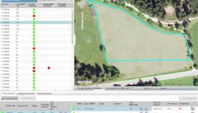
Gallery