Copernicus Data Space Ecosystem Webinar: Teaching Geography with Satellite Imagery
Join us for our upcoming Copernicus Data Space Ecosystem webinar on 23 May 2024 at 14:00 CEST (12:00 UTC) where we will demonstrate how to use satellite imagery for geography education! We'll show you how to search, explore and navigate satellite imagery to explain geographic patterns and processes. Our limited ability to understand scale is often a barrier to understanding what forms the Earth system. We can only understand what we see with our own eyes, but the processes that create landscapes are often hidden. By looking from above and through long-term time series, we can create visualizations that make most geographical processes understandable and memorable.
Additionally, the free tools in the Copernicus Data Space Ecosystem provide excellent platforms for hackathons, student work and interactive lessons.
In this 30-minute live webinar, our Community Evangelist András Zlinszky will show you how to:
- search, visualize and navigate satellite images
- support students to develop an understanding of spatial and time scales
- identify similar processes happening at different locations and scales
- share individual views, placemarks and configurations
- create highly compelling visualizations for export and download
The presentation will be followed by a Q&A session.
The webinar will be held on Thursday, 23 May 2024 at 14:00 CEST (12:00 UTC).
Reserve your spot - register now!
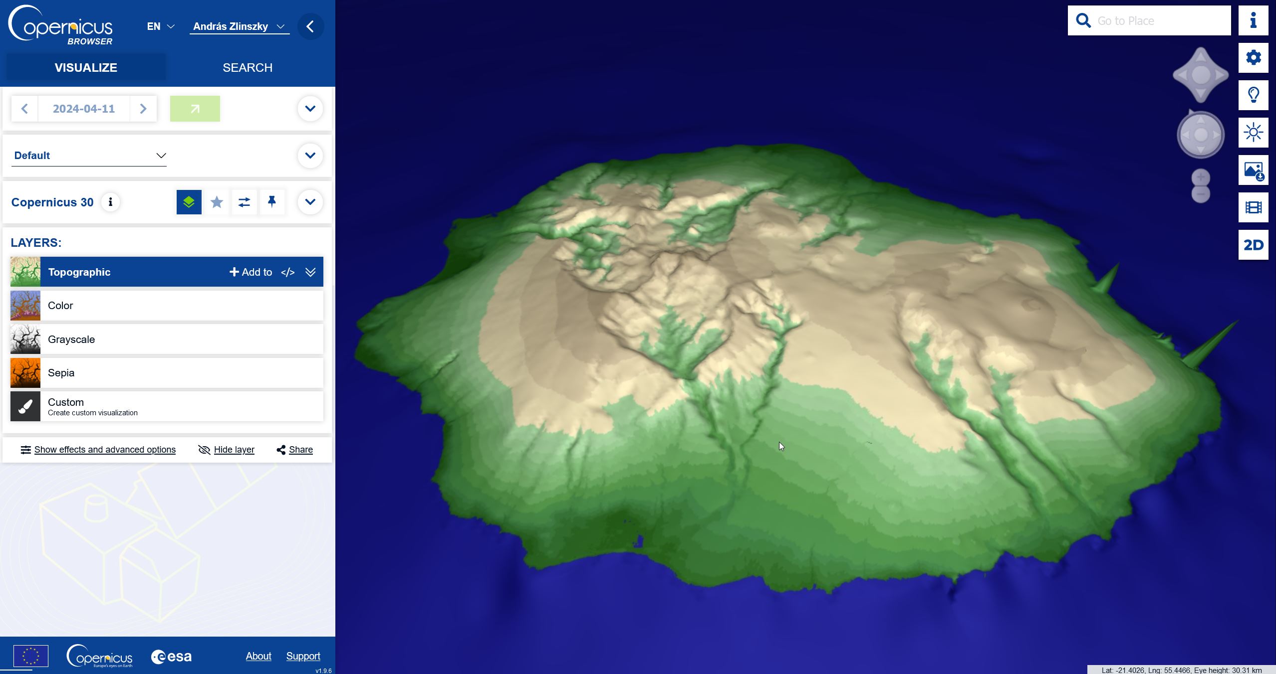
3D perspective view of the island of Réunion, overlaid with an elevation map of the terrain model. Copernicus Browser
---
Visit the Copernicus Data Space Ecosystem YouTube channel to watch the recordings of all CDSE webinars.